Year : 1780
Cartographer : NICOLAS DE BAILLIEUL
Dimensions(in cm) : 14.5 x 20.5
Colour : Uncoloured
Stock Reference : 2111.065
Year : 1780
Cartographer : BELLIN
Dimensions(in cm) : 25 x 35
Colour : Hand coloured
Stock Reference : 2106.083
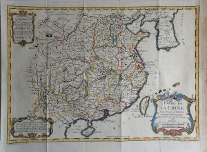
Year : 1780
Cartographer : BONNE
Dimensions(in cm) : 21 x 32
Colour : Uncoloured
Stock Reference : 0109.274
Year : 1780
Cartographer : BOWEN
Dimensions(in cm) : 23 x 19.5
Colour : Hand coloured
Stock Reference : 1810.185
Year : 1780
Cartographer : BELLIN
Dimensions(in cm) : 24.5 x 26.5
Colour : Hand coloured
Stock Reference : 2106.081
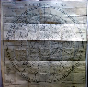
Year : 1780
Cartographer : COOK
Dimensions(in cm) : 53 x 53
Colour : Uncoloured
Stock Reference : 2306.072
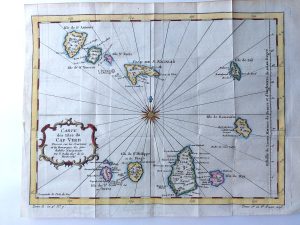
Year : 1780
Cartographer : BELLIN
Dimensions(in cm) : 24 x 31.5
Colour : Hand coloured
Stock Reference : 2306.010
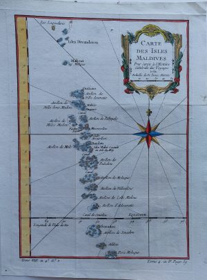
Year : 1780
Cartographer : BELLIN
Dimensions(in cm) : 28.5 x 40
Colour : Hand coloured
Stock Reference : 2306.024
Year : 1780
Cartographer : BELLIN
Dimensions(in cm) : 24.5 x 20
Colour : Hand coloured
Stock Reference : 2306.003
Year : 1780
Cartographer : BELLIN
Dimensions(in cm) : 21 x 30
Colour : Hand coloured
Stock Reference : 2306.019
Year : 1780
Cartographer : BELLIN
Dimensions(in cm) : 21.5 x 28.5
Colour : Hand coloured
Stock Reference : 2306.006
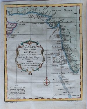
Year : 1780
Cartographer : BELLIN
Dimensions(in cm) : 22 x 15.5
Colour : Hand coloured
Stock Reference : 2306.013

 Year : 1780
 Year : 1780
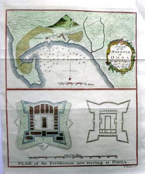


 Year : 1780
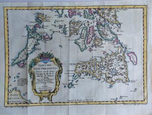
 Year : 1780