Interesting Cook chart of Tahiti with several small inset plans, from ‘Atlas Encyclopedique, contenant la Geographie Ancienne, et Quelques Cartes sur la Geographie du Moyen Age, la Geographie Moderne…’ by Bonne & Desmarest, Paris; folds
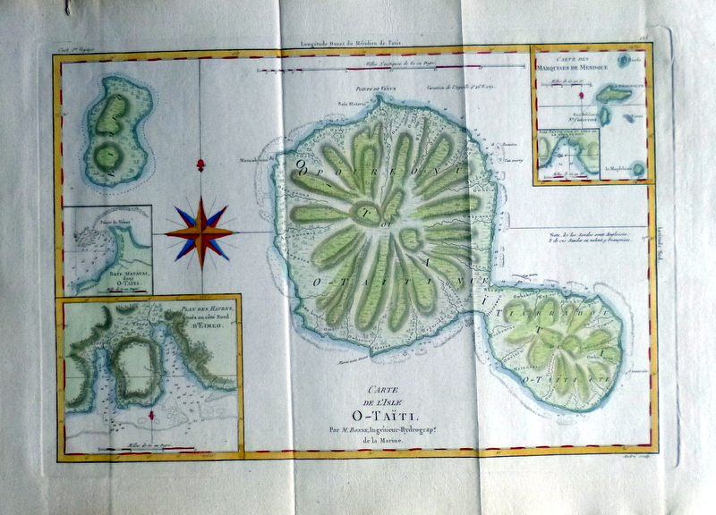
Carte de l’Isle O-Taiti. Par M. Bonne, Ingenieur-Hydrogrape. de la Marine.
£45.00
Bonne: Tahiti 1788
Availability: In stock
| Year | |
|---|---|
| Cartographer | |
| Colour | |
| Dimensions (cm) | |
| Stock Reference |