Interesting Cook chart showing parts of Papua New Guinea with inset plans of New Ireland, Southern Mindanao, Joseph Freewill Island, Sable Banks and Bonthain Bay, Makassar (Samalona), from ‘Atlas Encyclopedique, contenant la Geographie Ancienne, et Quelques Cartes sur la Geographie du Moyen Age, la Geographie Moderne…’ by Bonne & Desmarest, Paris; folds

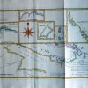
Carte des Decouvertes du Capit. Carterert dans la Nlle. Bretagne avec une partie du passage du Capite. Cook par le Détroit de l’Endéavour et les découvertes du Capite. Dampierre dans ces Parages.
£45.00
Availability: In stock
| Year | |
|---|---|
| Cartographer | |
| Colour | |
| Dimensions (cm) | |
| Stock Reference |