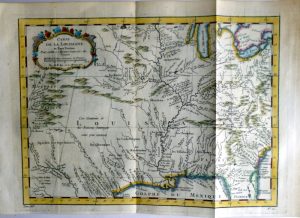
Year : 1757
Cartographer : BELLIN
Dimensions(in cm) : 22 x 30
Colour : Hand coloured
Stock Reference : 2211.012
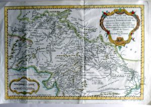
Year : 1757
Cartographer : BELLIN
Dimensions(in cm) : 22.5 x 30.5
Colour : Hand coloured
Stock Reference :
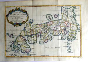
Year : 1757
Cartographer : BELLIN
Dimensions(in cm) : 18 x 27.5
Colour : Hand coloured
Stock Reference : 2211.002
Year : 1757
Cartographer : BELLIN
Dimensions(in cm) : 23.5 x 32
Colour : Hand coloured
Stock Reference : 2211.007
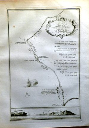
Year : 1750
Cartographer : BELLIN
Dimensions(in cm) : 21.5 x 15.5
Colour : Hand coloured
Stock Reference : 0010.527
Year : 1757
Cartographer : BELLIN
Dimensions(in cm) : 22.5 x 33.5
Colour : Hand coloured
Stock Reference : 2211.112
Year : 1759
Cartographer : BELLIN
Dimensions(in cm) : 23 x 34
Colour : Hand coloured
Stock Reference : 1911.105
Year : 1757
Cartographer : BELLIN
Dimensions(in cm) : 21.5 x 31
Colour : Hand coloured
Stock Reference : 2211.117
Year : 1757
Cartographer : BELLIN
Dimensions(in cm) : 25 x 25
Colour : Hand coloured
Stock Reference : 2211.119
Year : 1780
Cartographer : BELLIN
Dimensions(in cm) : 24.5 x 26.5
Colour : Hand coloured
Stock Reference : 2106.081
Year : 1747
Cartographer : BELLIN
Dimensions(in cm) : 21.5 x 14
Colour : Uncoloured
Stock Reference : 2305.203
Year : 1747
Cartographer : BELLIN
Dimensions(in cm) : 20 x 18
Colour : Uncoloured
Stock Reference : 2305.204
 Year : 1757
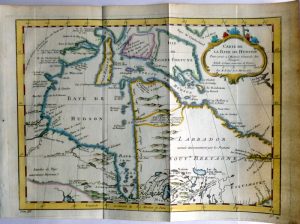 Year : 1757
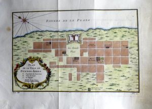 Year : 1757
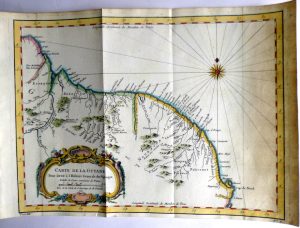 Year : 1757
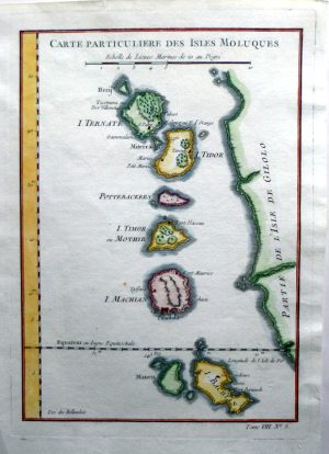 Year : 1750
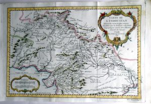
 Year : 1757
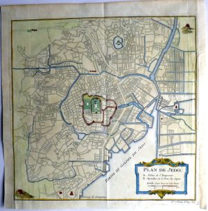 Year : 1757
 Year : 1747